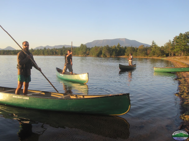
Our 4-week canoe expedition for 2016 will run from the Jack Mountain Bushcraft Field School in Masardis, Maine, to the Atlantic Ocean at Calais Maine. Along the way we’ll paddle the Aroostook, St. John, Eel and St. Croix rivers. We’ll also be tracing the ancient Maliseet Trail.
More information on the trip and the route is on the Wilderness Canoe Expedition Semester page.
From the page:
The 2016 Expedition
This year the summer canoe expedition crosses the line, literally, the political line between the US and Canada en route to the salt water at the Maine coast. Sitting around the guide shack one night this past winter we fell to looking at maps and talking about historic canoe routes of the northeast and how many of them are being lost to history as the ancient waterways have been replaced by highways and canoes have been relegated to hobby craft instead of the original sport utility vehicle that once connected tribes, families and individuals to each other and to the resources that made life possible.
The route this summer reflects our commitment to reestablishing a connection to our paddling past while also creating unique new canoe routes that challenge our abilities and push our concept of a wilderness expedition. The result is a hybrid wilderness/rural expedition that will start at the Jack Mountain Field School outside of Masardis Maine and will take us all the way to Calais Maine at the mouth of the Atlantic Ocean. This trip has it all: wilderness and solitude, rural modern culture, white water, flat water, upstream, downstream, legend, lore and mystery.
The Route
We will portage all of our gear from the field school campus down to the Aroostook River where we will paddle roughly 80 miles through the cities of Presque Isle and Caribou to the confluence with the St. John River over the border in New Brunswick. This border crossing will require all participants to carry a valid passport.
Once on the St. John we will navigate the big river for around 60 miles until we reach the ancient Maliseet village of Meductic a few miles upstream from the modern day town by the same name.
Appropriately named, Meductic means “end of the trail” as it represented the end of the ancient Maliseet Trail the connected the waterways of the Penobscot and Maliseet nations via the Eel River. For us it represents the beginning of the trail as we will ascend around 30 miles of paddling, portaging, poling and pushing our fully loaded canoes up the whitewater on the Eel.
There has been much mystery and legend surrounding the Eel River, but all I will say is there may or may not be a piece of gold the size of a small cow supposedly buried along the portage trail, you can read more here: http://www.maliseettrail.com/
At the end of the Eel lies two large lakes, Grand and Spednic Lakes that will lead us to Vanceboro and the beginning of our downhill run all the way to the ocean on the St. Croix about 55 miles downstream.
This trip will require solid canoe handling skills in a variety of water conditions from Class 2+ whitewater to big waves and exposed water on the St. John and Grand and Spednic Lakes. In all we will be poling, portaging and paddling over 300 miles in a little under 28 days. All participants must be competent poling a loaded canoe up and downstream in Class 2+ whitewater and paddling a fully loaded 18 foot canoe in big waves, high wind using variations of the J stroke and also on moving water using prys, draws, sweeps and braces. Expertise will be learned, but competence is required.


