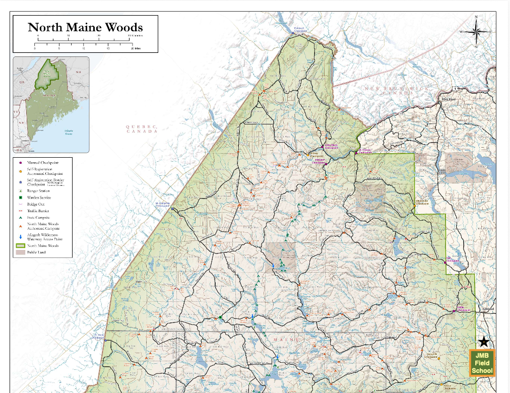
I recently updated our website with a bit of information about the neighborhood (see text below), and in doing so found this updated North Maine Woods map that I dropped our location on. There are so many places to explore around here that one would have to live a very long life to see them all.
Masardis, Maine is a small, rural town in central Aroostook county. It is characterized by wild spaces and just a few people. On our side of the river, the field school abuts the 525 acre Pollard Flat Wildlife Management Area, a state-owned tract of land managed for wildlife and conservation that recently doubled it’s size. Directly out our back door is the North Maine Woods, a 3.5 million acre working forest with no permanent residents, towns or pavement – it is 77 miles from our driveway to the Quebec border (see map above). On the other side of Masardis is the 16,500 acre Scopan Public Reserved Land, and we are a short drive from Katahdin Woods And Waters National Monument and Baxter State Park. Our area offers five canoeable streams within a few miles, as well as a large lake with remote campsites.
To see the full map, click here
#FullTangLifestyle
AroostookCounty